Day 2: Lines | #30DayMapChallenge
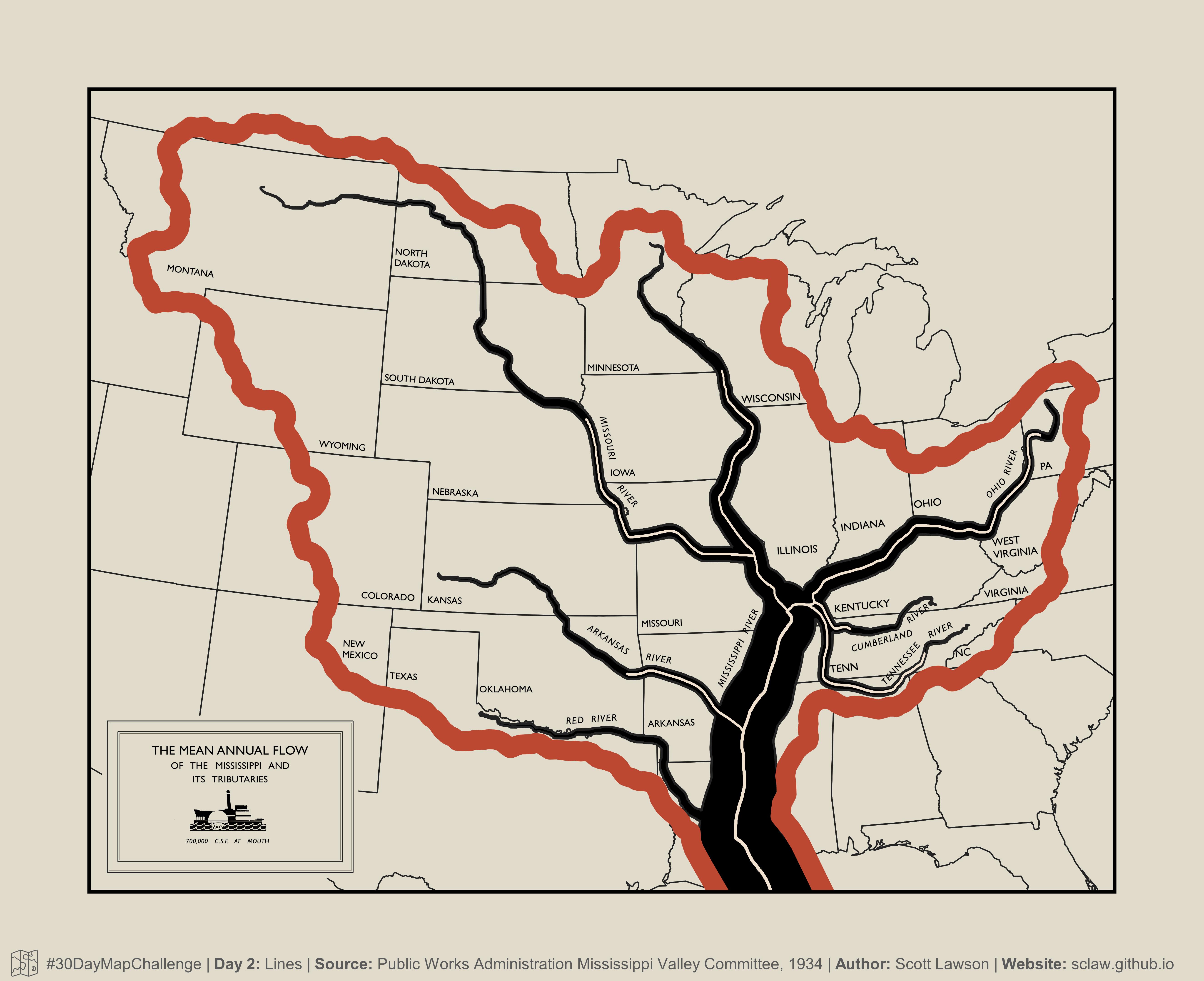
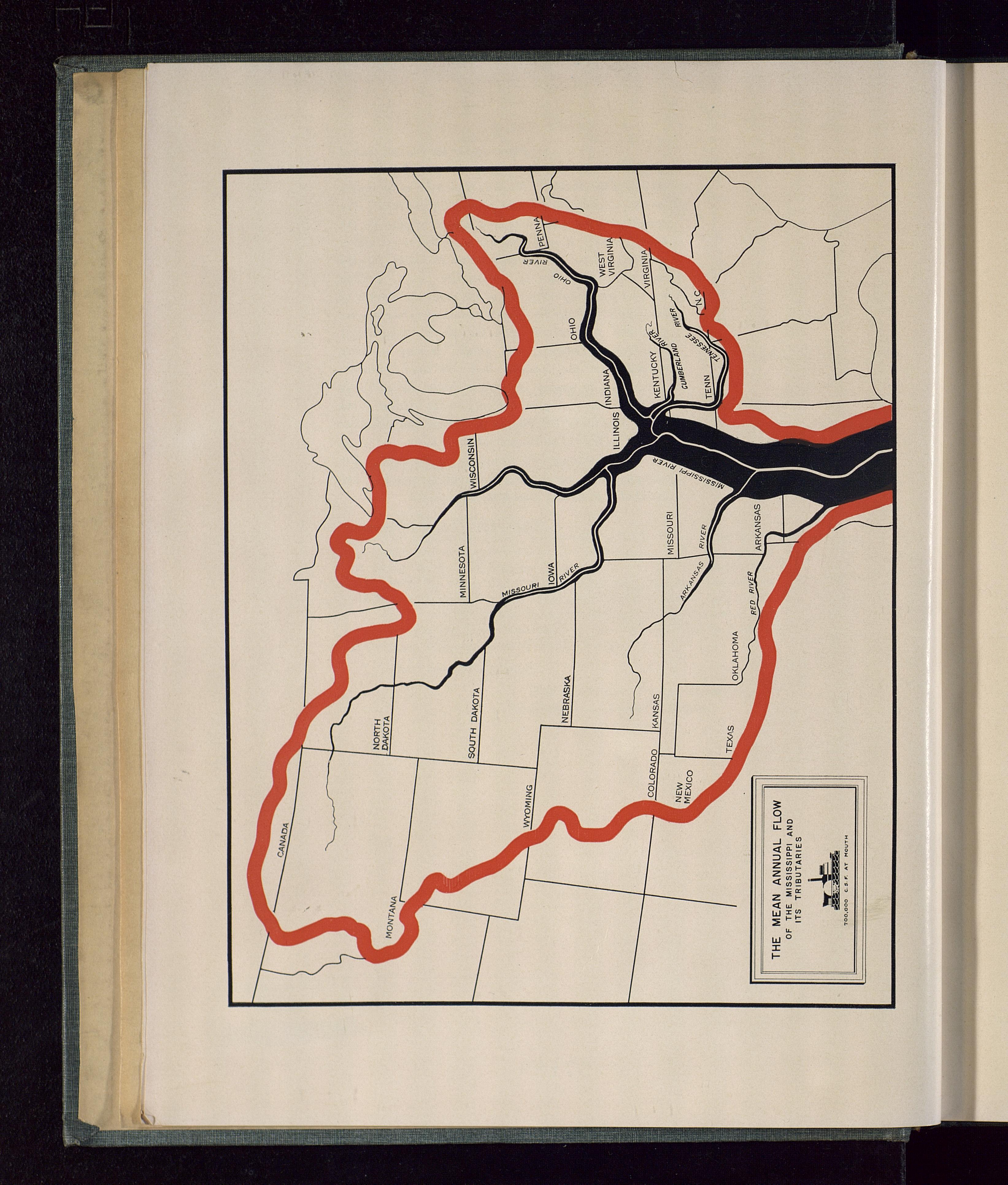
This is a recreation of one of my favorite maps. It comes from a 1934 report by the Mississippi Valley Committee of the Public Works Administration.
For my thesis research, I was reading some old papers on flood frequency analysis. Flipping through PDF scan after PDF scan of dry text, I flipped one more page to this map and fell in love instantly. It’s elegant and understated, abstracted and informative, detailed and straightforward. I love the color palette, that thick watershed boundary, the tapered river centerlines, the smaller white accenting centerlines, the fonts, and so much more.
It was an absolute blast to get to spend time recreating this map. This still has some rough parts, but I’ll keep improving it and hope to print it some time.
Original map citation
United States Public Works Administration Mississippi Valley Committee. (1934). Report of the Mississippi Valley Committee of the Public Works Administration; Submitted October 1, 1934 to Harold L. Ickes, administrator; Federal Emergency Administration of Public Works. Washington: U.S. G.P.O. [Link to Resource: https://exploreuk.uky.edu/catalog/xt7kpr7msd10]
30DayMapChallenge: https://30daymapchallenge.com/

