Day 6: Asia | #30DayMapChallenge
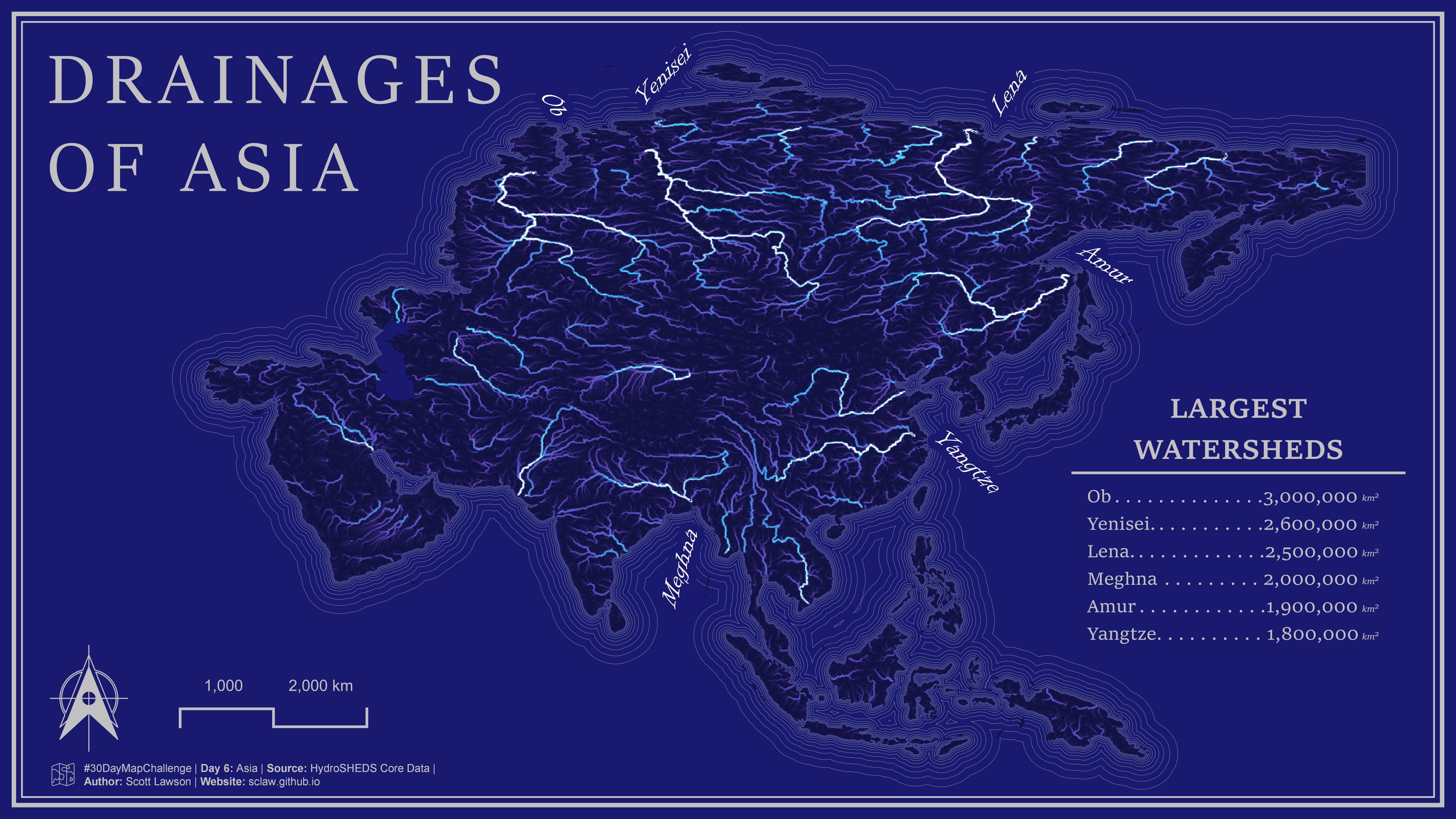
I do A LOT of raster-based hydrologic analysis, and one of my favorite rasters is Flow Accumulation! I snagged this data from the HydroSHEDS Core Data, which is a relatively new data source for me (Typically, I’m a big proponent of the TauDEM and SAGA tools). What’s really nice about the HydroSHEDS data is that they’ve pre-processed pit-filled, hydro-conditioned, flow-direction, flow-accumulation, and flow-length rasters for the globe. Not only that, but they also have all those products available at various resolutions. That was really handy for this project, because while there is a 3s resolution available, I opted for the 30s for faster computation time and lower storage requirements.
30DayMapChallenge: https://30daymapchallenge.com/
HydroSHEDS: https://www.hydrosheds.org/hydrosheds-core-downloads